The Way There: Chris Coleman, Shawn Keizer, and Jeff Wear left Chris' house in Williamstown NJ at 1100 EDT on the 20th. After an overnight stay in Mansfield OH, they drove to Quincy IL to pick up Mike Deason on the 21st. They all spent the night at Mike's house in Camp Point IL.
Friday, May 22, 1998: We leave Mike's house at 0750 CDT. The Storm Prediciton Center (SPC) had the eastern two-thirds of Kansas under a moderate risk for severe weather, so this was our target area. We called Jay Barnes, who was driving up from Texas to join us, and agreed to meet at a service area just outside Topeka KS.
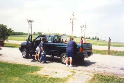
Once we all met up at the service area at 1300, Jay set up his satellite dish in the back of his truck so we could watch The Weather Channel (TWC). We did not have access to the Internet to get any upper air or surface data on the road, so TWC was our best option available. Based on what information we were able get, we decided to stay in the area and chase storms in an area between Topeka, Salina, and Wichita. The stratus overcast was beginning to thin, temps had risen into the low 80s, and dewpoints were approaching 70. Storms had not begun to fire yet, so we got a hotel room in Topeka and waited for them to do so.
By 1830, we had become impatient. Temps were in the mid 80s, dewpoints in the mid 70s, and all we had managed were some small cumulus. To add to our frustration, visibility was poor, so we couldn't see if any storms were builiding in the distance. From what we could see on radar, it appeared that some storms were beginning to develop over southeast Nebraska, so we left Topeka and headed north on US 75 to chase them. But we got into low overcast again once we got to Hoyt, and we decided to call of the chase and turn around in Holton.
Saturday, May 23, 1998: Jim Barker and his son arrived in Topeka from Michigan to join us for the weekend. We left Topeka at 1230 for our preliminary target area of southeast Kansas. We headed south down US 75 to Yates Center, then went west on US 54 and set up shop at a rest area between Neal and Toronto at 1400. We watched TWC and listened to radio reports here until 1600, then headed back east on US 54 to Iola. From here, we went north on US 169 to Garnett, where we refueled. Temps were around 90 and towering cumulus was finally beginning to build to our NW and N, but we were still plagued by poor visibility. After refueling, we continued north on US 169.
Just as we entered Miami County at 1730, a tornado watch was issued for eastern Kansas from Leavenworth County to Miami County. We began hearing reports on the radio that storms were firing north of Kansas City, so we took US 169 to Olathe, then I-35 to Overland Park, then I-435 east. We stopped in Overland Park around 1815 to get a visual. Towering cumulus were building everywhere, but our visibility of them was still restricted due to haze. After about 20 minutes, we got back on the road again. We took I-435 into Missouri, then went east on I-70 and US 40. At 1910, we pulled over at a park east of Lee's Summitt to take a look a building cumulus towers to our west, northwest, and north. None of the cumulus towers were particularly impressive - and tended to be thin and windshorn. We waited until just before sunset for a storm to get going, but nothing materialized, and we called off the chase at 2000.
On our way to finding a hotel, we did pass a warm front. As we passed the Kauffman/Arrowhead complex in Kansas City, the sky went from broken cumulus to stratus overcast - and temps dropped from the low 80s to the mid 70s. We then got a hotel room in Lawrence KS.
Sunday, May 24, 1998: We left Lawrence at 1100 for our preliminary target area of western Oklahoma. We took the Kansas Turnpike all the way to the Oklahoma border, passing through some debris cumulonimbus and light showers southwest of Emporia along the way. We continued south on I-35 to Blackwell, where we set up shop at a rest area at 1400. Skies were clear with 15 mile visibility, temperatures in the low 90s, and southeast winds at this time. We learned that much of western Kansas was under a tornado watch, so we took Hwy 11 west to Alva from Blackwell.
As we headed west out of Blackwell, visibility began to decrease - but cumulus began to form. At 1600, we stopped at a Wal-Mart in Alva to pick up supplies. Temps in Alva were in the mid 90s, and winds were still southeasterly. Storms had already fired in northwest Kansas, and we hoped outflow boundaries from these storms would trigger storms further south. Based on this, we decided to take US 281 from Alva back into Kansas.
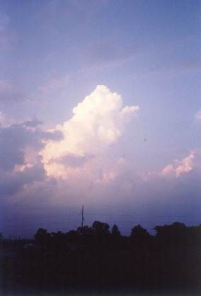
As we approached Medicine Lodge at 1700, we began seeing towering cumulus begin to pop to our northeast and east. From Medicine Lodge, we took US 160 east. Over the next thirty minutes, the towering cumulus to our northeast became the dominant buildup - and was a cumulonimbus by 1740. At this time, we decided to pull off the side of the road near Attica to take a look for about twenty minutes. While we were watching the cumulonimbus to our north-northeast, a new cumulonimbus developed about 20-25 mi to our south-southwest. However, we were not in position to chase these developing storms, so we decided to stick to the storms to our north.
We continued east on US 160 to Harper, then began going north on Hwy 14. At 1830, we stopped between Harper and Duquoin to watch the storm - which we were about three miles south of. The storm was now featuring a long beaver tail east-southeast of the precipitation core, and a rain-free base to its southwest. Initial reports had the storm moving northeast, so we headed east on a dirt road to stay ahead of it. But as we drove down this dirt road, we saw that the storm was actually heading southeast towards us. Fortunately, the dirt road network had south options, so we took these to stay ahead of the storm as well. We did see an area of rotation develop in the rain-free base around 1850, but this was short-lived as the storm quickly became dominated by outflow.
The dirt road network eventually led us back to US 160 in Danville, which we took east towards Wellington. Between Danville and Argonia, at around 1910, we saw a wall cloud to our northeast over northwest Sumner County. But as was the case with the previous storm, this storm became rain-wrapped and outflow dominant as well.
At 1935, we arrived in Wellington to fuel up. Tornado sirens began blaring as we payed the cashier, who immediately fled the station. Shawn suspected a storm was producing large hail to our east, so instead of continuing on US 160, we decided to take US 81 south.
At 1945, we saw another wall cloud about five miles to our west in south-central Sumner County. When we first sighted it, the wall cloud was becoming dominated by outflow - sloping away from the precipitation core and detatching from the rain-free base. But by 2000, the wall cloud reattached to the rain-free base. The storm was heading towards us, so we took US 166 east to escape it. By 2015, the wall cloud was sloping towards the core - and exhibiting visible rotation. We pulled over to take a look, then continued east on US 166 to I-35. When we got to I-35, precipitation was wrapping around the wall cloud, and darkness was setting in, so we decided to call of the chase then. Now our concern would be figuring out a way to get away from the storms.
We took I-35 south into Oklahoma. As we approached Blackwell, both Chris and Jay - who had been monitoring reports on radio and TV - alerted Shawn and Mike not to go south on I-35 any further. We took Hwy 11 east from Blackwell. This turned out to be a key move - as a tornado warning was issued for northwest Noble County (where we would have been had we continued south on I-35) just minutes later. We took Hwy 11 to US 77, south on US 77 to the Cimarron Turnpike - which we took east to Tulsa. Continous in-cloud, cloud-to-ground, cloud-to-cloud, and cloud-to-air lightning flashed to our north the entire drive back to Tulsa, where we spent the night.
Monday, May 25, 1998: Jim headed back for Michigan before sunrise. We left Tulsa at 1230 and took the Turner Turnpike to Oklahoma City. From there, we took the Bailey Turnpike to the Texas border. Temperatures were only in the mid 70s with a stratocumulus overcast and northerly winds through much of Oklahoma, but rose to the mid 90s with scattered cumulus once we passed the warm front around Lawton. We continued on I-44 to Wichita Falls, then took US 287 west to Iowa Park, where we set up shop at a rest area at 1600. Cirrostratus and altostratus spread over the area while we were at the rest area, which pretty much ended the threat of storms in the immediate area. Storms had fired along the Texas/New Mexico border and around San Angelo by 1800, but these were at least a three hour drive away. We then decided to get a hotel room in Wichita Falls.
At the hotel, we had a nice chat with Wisconsin chasers Don and Jennie Lloyd, and got to check out their ultra-cool chase vehicle.
Tuesday, May 26, 1998: Jay decided to head back to Austin, while the remaining four decided to continue the chase trip. We left Wichita Falls at 1300 down US 82 towards Lubbock. Temperatures were near 90 with scattered cumulus throughout our journey to Lubbock. As we approached Lubbock, we learned that a tornado watch had been issued for areas southwest of Lubbock - and heard that a severe thunderstorm warning had been issued for Andrews County. Jim had been monitoring these storms on radar at his home in Michigan, and periodically called us with updates. At 1700, we stopped in Lubbock to get gas and decide what to do. The storms in Andrews County were still going, yet new storms had begun to fire in eastern New Mexico. At first, we decided to go for the Andrews storm. We took US 87 south out of Lubbock.
As we headed south out of Lubbock, we began to get underneath anvil blowoff from the Andrews storm. As we approached O'Donnell, new storms began firing to our north, east, and south. We took Farm Road 1210 east to get a read on the storm, but when we saw that it wasn't going to amount to much, we took Farm Road 2073 north back to US 87, then US 87 south once again.
As we headed south through Dawson County towards Lamesa, we began to encounter gusty southeast winds. The winds kicked up a lot of red dust, which restricted our visibility. At the same time, it was becoming apparent we would have to core punch to get into a favorable position to chase the Andrews storm - so we turned around near Arvana and decided to go for the New Mexico storms instead. We took US 87 north back to Lubbock, then Hwy 114 west towards New Mexico.
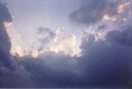
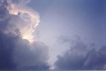
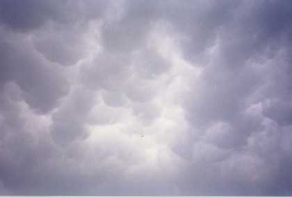
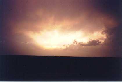
As we approached Whiteface, we got underneath the anvil blowff from the New Mexico storms - and was treated to a nice display of mammatus. We refueled in Whiteface at 1945, then took Hwy 125 through Lehman and Bledsoe. By the time we got to Bledsoe, we could see what appeared to be a ragged wall cloud. We were not able to see this for long, as precipitation wrapped around the mesocyclone. We continued to track this storm all the way to the New Mexico border, then decided to turn around and head back as sunset was approaching. On the way back to Bledsoe, we pulled over periodically to get pictures of a spectacular sunset. We pulled over again in Bledsoe, where Mike shot lightning pictures and we chatted briefly with a SKYWARN spotter from the National Weather Service in Lubbock who had been tracking the storm. The storm quickly died out after sunset (temperature dropped to a rain-cooled 62 degrees by 2130), and then made the long drive back.
The Way Back: We got back to Quincy at 1530 CDT on the 27th, where we walked around town for a bit and had a late lunch. We then dropped Mike off in Camp Point at 1800, then got back to Williamstown at 1300 EDT on the 28th.
Conclusion: As most chasers have found out this year, this hasn't been a good year for chasing in the southern Plains. We got into a tornado watch box four out of five days (and a moderate risk area the other day), and were on warned storms on two days, but the atmosphere didn't want to seem to cooperate with us. Even if we did see tornadoes, our view likely would have been spoiled by rain and haze - visibility out in the Plains was poor almost the entire time! As others have noted, the weather pattern was more summer-like than late spring-like, as what little activity has developed in the southern Plains this year has done so at night. Despite our misfortunes, I think I can speak for everyone in the group that I'd take five bad days chasing over five good days at work anytime - and look forward to making it out to the Plains again next year.
This page was last updated by Jeff Wear on 4-14-04 at 0054 CDT