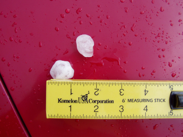
Shawn and Ed arrived at the hotel in Salina overnight, and would be accompanying us on our chase today. Today was looking like a potential outbreak, with a strong surface low moving into northeastern Kansas, strong southwest winds aloft over the central Plains, and a fresh Gulf of Mexico airmass pouring northward into the southern Plains. Our only concern were surface winds would not back enough to the southeast, but this problem has been overcome on other major outbreaks in the region (such as 5/4/2003). After lunch at Spangles and a data stop at the Salina library, we headed northeast of town to wait for storms to fire. Several storms formed shortly after 3pm southeast and northeast of Salina. We went after the storm to the southeast of Salina. We had to approach from the northwest, so we core punched through a little bit of 1/4 to 1/2 inch hail. We got close enough to see the rain free base through the precip, and may have even seen a funnel cloud near Navarre from 4:34-4:36pm. After that heavy hail wrapped back around the meso which blocked our view. We were able to find some 1 inch hailstones left behind by the storm near Navarre minutes after the storm went through.....