may 11, 2000
cyclic hp supercell in northeast iowa
Jay headed back home due to work committments early this morning, but the rest of the group continued on their trip. A fairly deep low (<990 millibars) tracked across Nebraska overnight, heading towards Iowa during the morning. This advancing low was drawing up some very moist surface air northward, but was also drawing in relatively warm, dry air from the southwest about 10,000 ft above the ground. Therefore we were once again dealing with less than ideal visibility (due to the surface moisture), as well as a strong cap everywhere south of I-80. We figured that if the cap was going to break at all it would do so north of Des Moines, so northern and eastern Iowa was our target today. Well the cap did break, and it broke explosively, resulting in numerous tornadoes north and northeast of Waterloo IA. Concerned that storms may backbuild, and that we may get stuck in heavy traffic in Waterloo, we elected to stay west of the storm. We missed most of the show as a result, although three of us got a very brief glimpse of a rope tornado around sunset. We were treated to a very intense lightning display on the way back to Waverly IA.
|
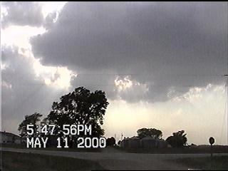
Updrafts begin assaulting the cap over Nevada IA. A few updrafts, such as this one, exhibited a hard texture. It would be at least another hour before sustained convection would get going, however. |
 |
 |
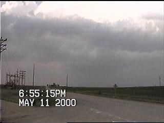
The cap has been torn open! Here's a view of the base of the first storm to develop in Story County IA. It looked windshorn and was dropping light precipitation, but the wind direction switched from southwest to southeast as it moved to our northwest - then back to southwest as it moved east. This wouldn't become the infamous Waterloo storm however... |
|
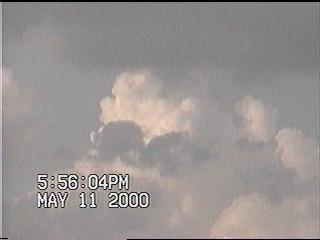
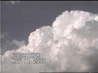
...this tower exploding further off to the northeast would be!!! |
 |
 |
Buried in the haze is the first wall cloud we saw in association with the supercell. At this point the storm had already dropped one tornado in southeastern Butler County, and was minutes away from dropping more in the Cedar Falls/Waterloo area. If a tornado was occurring at the time of this capture, it wasn't visible to us. |
|
Debris litters the countryside in northeastern Black Hawk County. It appears that this damage in this image was from a structure that was totally demolished. Not knowing the construction of the structure before the tornado struck, we can't make any assessments of the intensity of the tornado as it passed through. We hope that the emergency vehicles that were combing the backroads as this video was being taken did not find any injured (or dead) victims. If they did find any injured victims, we hope that they got the most immediate medical treatment possible. |
 |
Go on to the next page.